CIRM Secretary talks about the mapping in the environmental, social and economic areas
By First-Lieutenant (RM2-T) Luciana Santos de Almeida – Brasília, DF
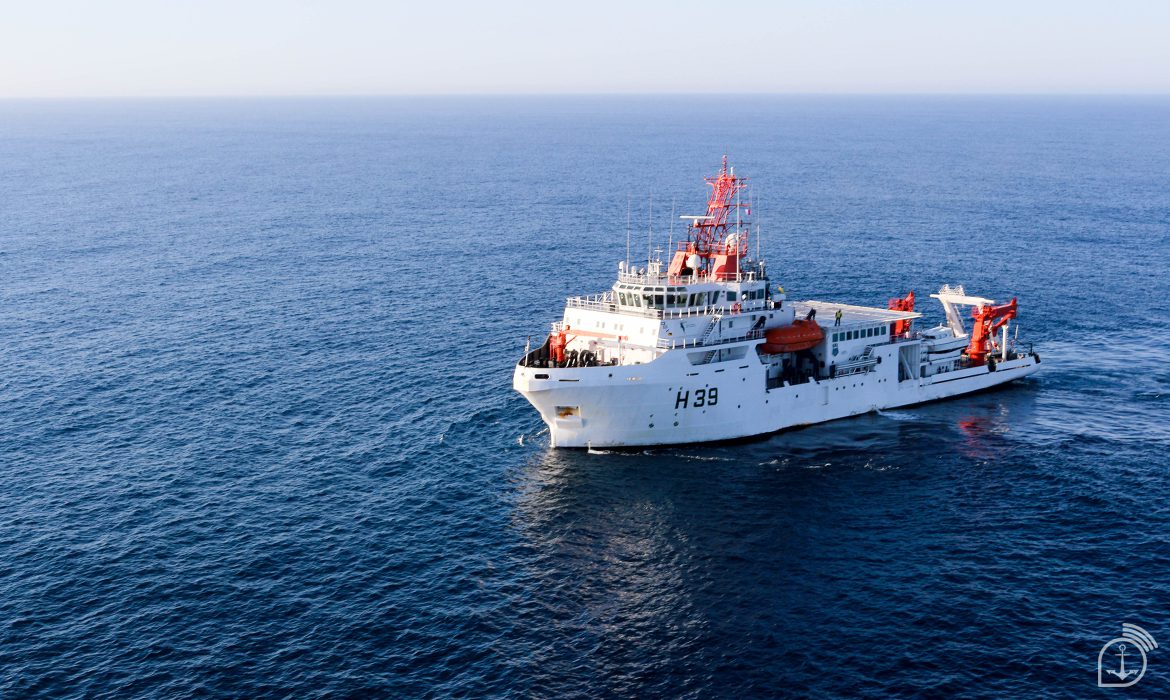
The first stage of the Brazilian Marine Spatial Planning (PEM) will be carried out in the South marine region – which comprises the states of Paraná, Santa Catarina and Rio Grande do Sul. The PEM intends to establish the most rational use of marine space and the interactions between its uses, that is, to map the environmental, social, and economic potential of the Brazilian sea coast. This pilot project is being coordinated by the Secretariat of the Interministerial Commission for the Resources of the Sea (SECIRM), a military organization of the Brazilian Navy, which will count on resources of the National Bank for Economic and Social Development (BNDES) to have its first stage carried out. Inclusively, until next March 10th the bank’s Public Selection will be open to support the technical study necessary to implement the project in this marine region.
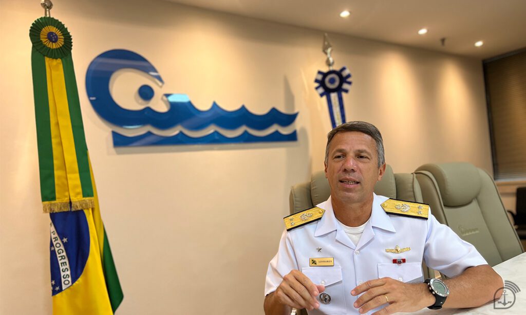
Agência Marinha de Notícias interviewed the Secretary of the Interministerial Commission for Sea Resources (CIRM), Rear-Admiral Marco Antônio Linhares Soares, who explained what the implementation of the PEM represents for the country.
Secretary, what is the Marine Spatial Planning?
The PEM is a mapping of the marine space, which will identify the areas of the ocean, in order to know its potentialities in the environmental, social, and economic areas. And, to be good managers of resources, we need to know our marine space well in order to manage human activities, improve compatible uses, and reduce conflicts between them. Many countries already do this planning and divide the marine space into areas of oil and gas, offshore renewable energy, maritime transportation, fishing and aquaculture, and conservation units, for example.
According to the United Nations Educational, Scientific and Cultural Organization (UNESCO), the EMP “is a public process of analyzing and allocating the spatial and temporal distribution of human activities in marine areas to achieve ecological, economic, and social objectives that have generally been specified through a political process.” At the global level, the EMP is considered the great “driving engine” of a country’s Blue Economy, as it simultaneously provides legal certainty, which is indispensable to investors; the generation of jobs and foreign exchange for the coastal state by stimulating sustainable activities in the Sea; contributes to the achievement of the Sustainable Development Goals (SDGs) of the UN Agenda 2030; safeguards the necessary ecosystem services, as well as contributing to the mitigation of conflicts in the marine environment. In addition, the implementation of the EMP is a commitment made by the Brazilian State in 2017, during the United Nations Oceans Conference.
We must also emphasize that the South Atlantic Ocean, the Coastal Zone, the Exclusive Economic Zone, and the Brazilian Continental Shelf are strategic for development and national security due to their extension and the country’s maritime vocation. Therefore, we need to manage this heritage, and to do this efficiently, we need to implement the Marine Spatial Planning in Brazil.
Why is this planning going to start with the southern marine region of the country?
The South marine region was chosen as the first stage, basically because it has the following factors:
-Marine border with another country: the experience to be acquired with the implementation of the PEM in the border region with Uruguay will be relevant, later, for the North region of Brazil, due to the border with French Guiana. On this occasion, it will be necessary for the Brazilian State to negotiate with France;
-Representativeness: its marine area corresponds to 13% of the whole Blue Amazon area;
-Relevance: it concentrates several marine ecosystems, conservation units, besides diversified and expressive economic activities (for example, it has five of the ten main ports of Brazil and important industrial fishing activities); and
-Availability of minimum data and marine metadata for the implementation of the EMP.
When we talk about mapping a marine area, does this mean using the data as you mentioned above or also collecting data in loco with the support of ships and then consolidating the data?
Basically, the marine data to be used in the implementation of the EMP in Brazil will be secondary data, i.e. those that have already been collected, tabulated, sorted, and even analyzed, with objectives other than those of the research in question. Besides the internal source, constituted by the database of the agency responsible for the collection, other external sources can be consulted, such as reports generated by organizations, educational institutions, research institutes, scientific publications, entities and other governmental and non-governmental sources.
It is important to emphasize that the successful implementation of the PEM presupposes the existence and continuous maintenance of a national data infrastructure, capable of ensuring easy, fast and safe access to the entire collection of marine data collected in the Blue Amazon. In this sense, the contribution of the Brazilian Institute of Geography and Statistics (IBGE) has been fundamental, by making available the National Spatial Data Infrastructure (NSDI), established by Decree No. 6.666 of November 27, 2008, representing a huge gain in time and a significant reduction of costs for the implementation of the EMP in Brazil by allowing the integration of data in order to subsidize the preparation of the Marine Spatial Management Plan and the Situation Maps, which will present the spatial and temporal distribution of uses and ongoing and potential activities in the Brazilian maritime area.
How long will it take to conclude the planning? And for the rest of the country?
In the southern marine region of the country, the forecast is three years. For the rest of the country, the estimate is that we will have the PEM concluded by 2030.
What are the current and potential sectors that stand out the most in the Brazilian marine space?
This immense Brazilian maritime area, with 5.7 million km2, called the Blue Amazon, is home to many mineral riches and a fantastic biodiversity. Among the main sectors, I highlight: fishing and aquaculture, oil and gas exploration, mining, navigation and ports, safety and security, tourism, renewable energies, and the environment.
Recently, a public notice for the PEM Pilot Project was published by BNDES. How does this partnership work?
BNDES is an essential partner of SECIRM in the EMP Pilot Project. The Secretariat will be responsible for the best efforts to prepare a proposal for a legal instrument to support the implementation of the Marine Spatial Planning in Brazil and the associated governance structure, as well as the competent information to the UN to register the implementation stage of the Marine Spatial Planning in the southern marine region of Brazil. BNDES will be responsible for the financial contribution, for conducting the Public Selection process, and for monitoring the study carried out by the contracted company.
The Public Selection will elect a proposal to obtain non-reimbursable financial support from the Project Structuring Fund to carry out a technical study necessary to implement the PEM Pilot Project in the Southern Brazil marine region. The contracted partner will elaborate the diagnosis of current and potential uses of the marine region; it will build a decision support tool – a Geoportal, besides promoting the formation of actors and training for the use of this tool. Finally, it will publish a study and a proposal for a formal document for the PEM, considering the marine areas and their reflection on the coastal areas. More details about the application and participation are on the bank’s website and will be available until March 10th of this year, when the selection will end.
Finally, Secretary, with the mapping in hand, the Navy will have more facilities regarding the management of the sea’s resources?
The mapping in hands will allow the Navy and the Brazilian State a holistic view of living and non-living resources and the current and future potential of the Blue Amazon, allowing public managers to make the best decisions for the country and our society, always taking into account the social, environmental, and economic aspects.
Source: Agência Marinha de Notícias *** Translated by the DEFCONPress FYI Team ***