Oceanographic research benefits industries and the marine resource exploration sector
By Lieutenant-Captain (RM2-T) Camila Marques de Almeida – Brasília, DF
Although the oceans and seas cover 71% of the planet, the United Nations Organization (UN) estimates that less than 5% of this water mass is effectively explored and scientifically known. Based on this information, Brazil has committed with the United Nations Educational, Scientific and Cultural Organization (UNESCO) to the execution of the program of the Decade of Ocean Science for Sustainable Development, to be implemented until 2030.
In this context, the Interministerial Commission for the Resources of the Sea (CIRM) carries out the “Pro Blue Amazon” action, which executes oceanographic research with the purpose of promoting scientific knowledge, conservation, and sustainable use of this ocean area, under the perspective of the blue economy.
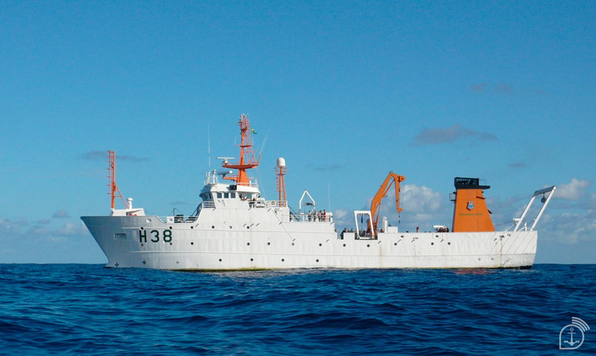
This year, the crew of the Hydro-Oceanographic Ship (NHo) “Cruzeiro do Sul” carried out the commission “Pro Amazônia Azul I” on the coast of the States of Ceará, Rio Grande do Norte, Paraíba, Sergipe, and Bahia, to do hydrographic surveys in support of the Brazilian Geological Service, the Federal University of Rio Grande do Norte (UFRN), the Federal University of Ceará, and the Institute for Scientific and Technological Research of the State of Amapá, which participated with 18 researchers. The activities developed characterized the submarine reliefs, as foreseen in the Hydrography Work Plan of the Directorate of Hydrography and Navigation (PTHidro).
Furthermore, these studies in regions that still lack hydro-oceanographic data contribute to the various sectors of exploration of marine resources and offshore industries (wind, oil, fishing, among others), collaborating with national sovereignty.
Scientific partnership
The partnerships between institutions and universities allow for the embarkation of researchers, professors and students, contributing to the support of research and the scientific community by the Brazilian Navy (MB). The exchange of knowledge with the academic sector allows a synergy between the various sectors involved with research in Brazilian jurisdictional waters.
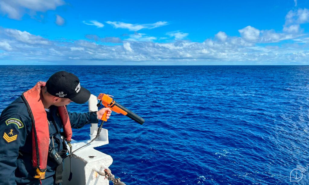
According to the Commander of the NHo “Cruzeiro do Sul”, Frigate Captain Claudio Luiz Pereira Batista, the operation of hydro-oceanographic equipment is complex, making the presence of specialized military personnel indispensable. “The time required to perform the survey of extensive areas requires the crew to remain operating for up to 17 consecutive days, away from shore, and sometimes under unfavorable weather conditions, which requires a highly trained crew,” he explained.
For Professor Narelle Maia de Almeida, from the Geology Department of the Federal University of Ceará, most Brazilian research institutions and universities do not have vessels to conduct research in the ocean, and, therefore, the partnership between institutions and the MB is essential. “Several projects have been and are being jointly developed, which actively contribute to the considerable expansion of knowledge of the Brazilian continental margin and the South Atlantic, in its various aspects: scientific, academic, strategic, national sovereignty, environmental management, dissemination, and training of human resources,” she said.
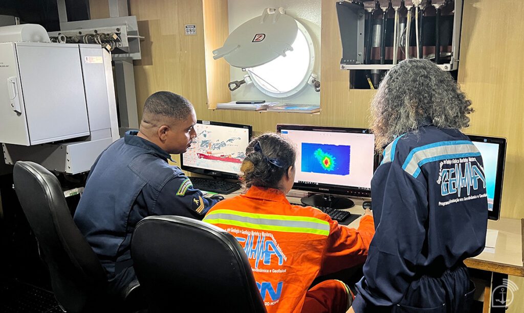
An example of action taken in the “Pro Blue Amazon I” commission was the collection of bathymetric data, which is the measurement of depth in a certain place, in some areas near the coast of Rio Grande do Norte that were practically non-existent. With this, the joint action of the commission enabled the characterization of submarine canyons and a better description of the seabed of the Potiguar Basin.
Professor Helenice Vital, from the UFRN Geology Department and coordinator of the SeabedMap, Geohazards and Tectonics Projects, explained that these data collected on the coast of Rio Grande do Norte will help minimize a large gap in the field of geological oceanography and Brazilian marine geology, through the Geological Mapping of the Brazilian Equatorial Margin. “Several never-before-known submarine canyons have been mapped in detail. Stunning images were acquired and from the products accurate and thorough maps can be generated that will assist in the Marine Spatial Planning of the region and the development of a sustainable blue economy,” he explained.
The hydro-oceanographic surveys, from the national point of view, are important not only scientifically, but also strategically and for the sovereignty of the nation. “Knowing the Blue Amazon promotes concrete information for the implementation of relevant public policies, for the efficient management of natural resources in the coastal and oceanic areas of the country, as well as supplying data for the National Oceanographic Data Bank and, consequently, for the National Infrastructure of Marine Spatial Data,” concludes Frigate Captain Claudio.
Source: Agência Marinha de Notícias – *** Translated by DEFCONPress FYI Team***