(*) By Ramón Montañez, Director of Strategy for International Markets, Motorola Solutions
Latin America is the second most disaster-prone region in the world¹ in a context marked by the effects of climate change. Since 2000, the UN recorded that 152 million people have been affected by more than 1,205 natural disasters in the region, including floods, hurricanes, earthquakes, droughts, avalanches, landslides, fires, extreme temperatures and volcanic events.
However, when we look at the global budget allocated to disaster risk reduction, only 10% is invested in preparing for unplanned events or disasters, while Japan, the world leader in disaster risk management, allocates approximately 80% of its budget for this purpose, according to the World Bank. So what is needed in Latin America to develop a more proactive and effective approach to natural disaster response management?
According to the report “Facing Risk”, published by the Development Bank of Latin America² , one of the main recommendations to reduce risks is to make use of technological evolutions. One of the main advances in communication technology has occurred with radiocommunication (voice).
Modern radiocommunication networks and systems remain the backbone of any operation and have evolved to the point that interoperable communications between emergency and public safety agencies flow more easily for risk management thanks to the use of worldwide standards such as P25, TETRA or DMR.
Today, radios offer, in addition to voice and security, data applications with extra features such as alert buttons, automation sensors, messaging, heart rate monitoring, GPS, perimeter controls, post-earthquake structure monitoring, arrival times, to name a few.
The radios can interoperate with other types of devices, allowing the unification of voice and data – such as group calls and location – from various platforms to enable communication between different emergency agencies.
In addition to safe and immediate communication, detailed recognition of a situation is vital. This is exactly what intelligent video security systems enable by means of fixed and mobile cameras. Today, these cameras capture as many relevant details as possible in the images, such as models, color or license plates of vehicles, unusual patterns or behavior of people, etc.
Features such as appearance search and facial recognition are very useful in the search for missing persons in a natural event. And, the predictive and preventive analysis of the software based on artificial intelligence (AI) and machine learning tools for emergency management, allows you to safely predict what is happening or about to happen in advance for immediate intervention, execution of emergency plans, and mobilization of public services.
In addition to fixed cameras, which are usually installed at strategic points in cities, there are body cameras that first responders can wear on their uniforms, and those installed in emergency vehicles. But what about complex rescue situations in large areas where there is no way to reach the team?
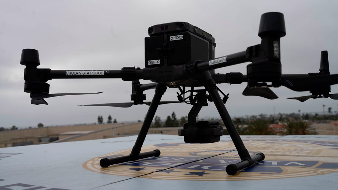
Unmanned aerial vehicles (UAVs), better known as drones, can maintain constant and prolonged flight with secure high-speed data transmission and high-definition video to recognize situations in real time over large areas. Ambulance drones can remotely assist a person in a cardiac arrest with automated external defibrillator equipment.
In addition, they can be managed centrally and even have infrared image capture capabilities and with high definition, without interruptions, as well as laser measurement sensors that maximize time and avoid unnecessary risks and wear and tear to the security agents.
For this, a drone solution offers the different agents involved in disaster response access to video, control cameras, and even flight direction autonomously and under safe parameters to perform the service under “telepresence”. It is also essential to ensure that voice and information from multiple sources can be processed in seconds and to have a comprehensive and detailed understanding of the situation in order to take quick and effective action.
To gain visibility for these technological advances, the Command and Control Center (CCC) has also evolved, acting as the brains of the operation. With it is possible to unify emergency calls in an automated dispatch console.
Through software, it selects, prioritizes and analyzes in seconds large amounts of information, such as meteorological readings, satellite images, predictive alert system measurements, sensors, social networks, topography, video transmission via drones and cameras, etc.
Most of the time, the arrival of a major natural event is unavoidable. Therefore, it is necessary to prepare and rely on the innovations of technology, so that when the inevitable happens, the damage is as small as possible.
[1] UN Office for Humanitarian Affairs report, 2020.
[2] “Facing Risk,” Development Bank of Latin America (CAF) and The New School’s Latin America Observatory, 2019.
*** Translated by the DEFCONPress FYI Team ***
