“New Bandeirantes”: crew of the Hydro-Oceanographic Ship “Cruzeiro do Sul” conducts research to support Brazil’s demand to increase the maritime area in which the country can exercise sovereignty
By Second Lieutenant (RM2-T) Augusto Rodrigues – Belém, PA
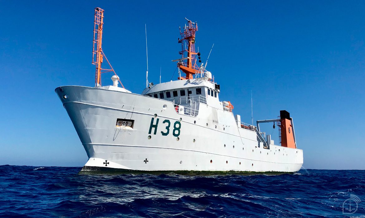
The Hydro-Oceanographic Vessel (NHo) “Cruzeiro do Sul”, operated by the Directorate of Hydrography and Navigation of the Brazilian Navy, docked this Friday (10) at the Port of Belém (PA). This is a strategic stop for the Ship, which is conducting research in support of the Brazilian Continental Shelf Survey Plan (LEPLAC), a State program whose purpose is to determine the maritime area, beyond the 200 nautical mile limit, in which Brazil can exercise sovereign rights to exploit the natural resources of the seabed and subsoil.
In this commission, the Ship has the tasks of collecting bathymetry (depth measurement of water masses) and shallow seismic (characterization of bottom and sub-bottom marine features) data in order to strengthen the identification of the slope base (steeply sloping oceanic region), especially in the regions of the Pará-Maranhão Mega Slip and the Brazilian North Chain.
“During this stage, we collected bathymetry data, using the EM-122 multibeam echo sounder, and shallow seismic data, using the SBP-120 sub-bottom profiler, in order to contribute to the identification of the slope base, to assist LEPLAC’s claims before the Commission on the Limits of the Continental Shelf, at the UN. The Ship did this work on the Brazilian equatorial margin, basically in the oceanic region adjacent to the states of Ceará, Maranhão and Pará”, explains the Commander of the NHo “Cruzeiro do Sul”, Frigate Captain Claudio Luiz Pereira Batista.
The United Nations Convention on the Law of the Sea defines that the continental shelf of a coastal state comprises the bed and the subsoil of the submarine areas which extend beyond its territorial sea, along the entire length of the natural extension of its land territory, up to the outer edge of the continental margin, or to a distance of 200 nautical miles.
The UN allows countries to extend their maritime limits, provided they submit studies proving the extent of their continental shelf. The rule consists in determining, from the definition of the depth of the sea and the thickness of sediment, how far the natural extension of the submerged continental mass exists.
“Just as the Bandeirantes, in the old days, expanded westwards, in search of riches, and defined the frontiers to the west of Brazil, we are in a phase of determining the outer limit of our last frontier, to the east of Brazil, beyond 200 nautical miles. This will be a legacy for future generations, since Brazil will have the opportunity to have the right to sovereignty and exploration of the mineral wealth of the seabed and the marine soil and subsoil”, explains Commander Claudio.
Route
The “Cruzeiro do Sul” left on February 6th, from the Paulo Irineu Roxo Freitas Pier, located in the Navy’s Hydrography Base in Niterói (RJ). The first stop was at the Port of Fortaleza (CE), where the vessel remained from February 17 to 22. The Hydro-Oceanographic Ship will remain in the capital of Pará until March 14, when it will leave for another stopover in Fortaleza, Natal (RN), until it returns to the Base in Niterói, on April 20.
Hydro-oceanographic Ship “Cruzeiro do Sul
With a crew of 66 military personnel, composed of 11 officers and 55 soldiers, the ship has the capacity to receive 16 researchers, who contribute to the development of research activities at sea.
The “Cruzeiro do Sul” is 65.7 meters long, with a breadth of 11 meters and a draught of 6.5 meters. It can travel at a maximum speed of 9 knots (16.6 km/h). The vessel is equipped with two oceanographic winches for deep waters, two echo sounders, and a meteorological station.
Source: Navy News Agency
*** Translated with www.DeepL.com/Translator (free version) ***