Director of Hydrography and Navigation explains how Hydrographers ensure navigation safety and contribute to development
By Agência Marinha de Notícias – Brasília, DF
If navigating is necessary, as it says in one of the most famous poems of the Portuguese writer Fernando Pessoa, nothing better than a safe and calm way. It is Hydrography that makes navigation safety possible and, little by little, has played a fundamental role for anyone who wants to venture into the seas and rivers. Throughout the years, hydrographic studies have gained a multidisciplinary character, incorporating several technical and scientific knowledge.
This evolution would not have been achieved without the professionalism and dedication of hydrographers, professionals with active participation in maritime and river research and responsible for safer navigation. This Wednesday (28), the day is dedicated to them, whose performance has increased the quality of information and services provided to sailors.
Thus, the Marine News Agency talked to the Director of Hydrography and Navigation, Vice-Admiral Renato Garcia Arruda about hydrography and its challenges.
What are the main advances of Hydrography in the last years?
Along the years, a series of academic areas were incorporated to the Hydrographers’ knowledge, including disciplines from other professionals’ training courses such as cartography, meteorology, oceanography, geology, among others, giving hydrography a multidisciplinary character and providing advances in different segments.
The use of numerical computational models and of a Numerical Weather Prediction Center, with high performance servers, has provided advances in the area of marine meteorology. In cartography, the production of electronic nautical charts and their adaptation to new international formats have increased the reliability of the information. Navigation has incorporated digital elements, associated with the concept of enhanced navigation, the “e-Navigation”.
Navigation aids have evolved, acquiring greater reliability, resilience, and information integrity. As a result of the tasks performed by Hydrographers, society has received reliable and internationally recognized products, through nautical charts, aids to navigation, publications and standards for navigation, and environmental forecasts.
The maritime community has started to follow weather and oceanographic forecasts more frequently, especially warnings of bad weather. The advances in hydrography are continuous and demand a daily effort to keep up to date with the technological evolution inherent to this activity. As quoted in the Hydrographer’s Song: “There will always be a lot left to do…”.
What are the challenges to be overcome by Brazilian Hydrography?
The technological advances broaden the branches of knowledge associated with hydrographic activities, providing opportunities and new challenges to our Hydrographers. Among the challenges are: the maintenance of the naval means; the updating of the equipment and the computer park; the updating of the products and their adequacy to international standards; and the formation and training of personnel.
These challenges are overcome by means of programs for the maintenance of the means, planning for the application of financial resources, participation in conferences and international hydrographic forums, and the constant review of personnel training plans and course curricula.
What studies have been highlighted in recent years in the mapping of Brazilian seas and rivers?
The Blue Amazon is becoming increasingly important in oceanopolitics because it has a large amount of wealth and also because most of the trade is carried out through seas, rivers, and oceans. Thus, the studies that have been conducted are aimed at the knowledge of its characteristics, as well as the development of tools that increase the safety of navigation.
In this context, we have the constant improvement in the productivity of the analysis of hydrographic surveys carried out in the Blue Amazon and inland waters, as well as in the analysis of projects for the establishment, alteration, or cancellation of navigation aids. The main studies in progress are those related to the maintenance of nautical instruments, the operation of lighthouses, geospatial data survey, printing services for nautical products, and the dissemination of meteoceanographic information. Besides this, the modernization of the Differential Reference Station Network of the Global Navigation Satellite System (DGNSS) and the improvement of hydrographic products in support of Naval Power are planned.
We also highlight the hydrographic surveys and logistical support carried out in the far Antarctic, defending Brazilian interests beyond our Exclusive Economic Zone (EEZ). Furthermore, we have conducted hydrographic surveys and research on the Rio Grande Rise, to better support the arguments of our “Bandeirantes das Longitudes Salgadas”, in the quest to expand the extension of our Blue Amazon, before the United Nations.
Who are the main beneficiaries of hydrography services?
When one thinks of hydrography, many people think only of nautical charts or publications. While it is true that hydrographic services are responsible for such official documents that are essential for the safety of navigation, the range of users of hydrographic products and services is much wider and goes far beyond the maritime community and the naval profession.
Hydrography is crucial in many activities, such as marine resource exploration, environmental protection and management, maritime boundary delimitation, marine spatial information infrastructure, sports and recreation activities, maritime defense and safety, flood and inundation models, coastal management, tourism, marine sciences, and others.
Without hydrography, accidents at sea would be more frequent, with loss of life and pollution of the environment, rescue and salvage operations would be more difficult, there would be no offshore installations, submarine cables, pipelines or oil platforms, no safe ports, no secure shipping routes, maritime traffic would decrease and, consequently, international trade, maritime borders would not be implemented with the necessary rigour, resulting in increased conflicts. In short, the whole society is benefited, directly or indirectly, by the services of hydrography and without this activity life would be much more difficult.
What is the profession of Hydrographer like?
The challenges of the profession are aligned with the challenges of Hydrography. Thus, they involve daily care of the ships and their equipment, scheduled maintenance services, search for professional updating and access to the disclosure of new tools or procedures that may introduce modifications in the conduction of hydrographic activities, including exchanges with other hydrographic services.
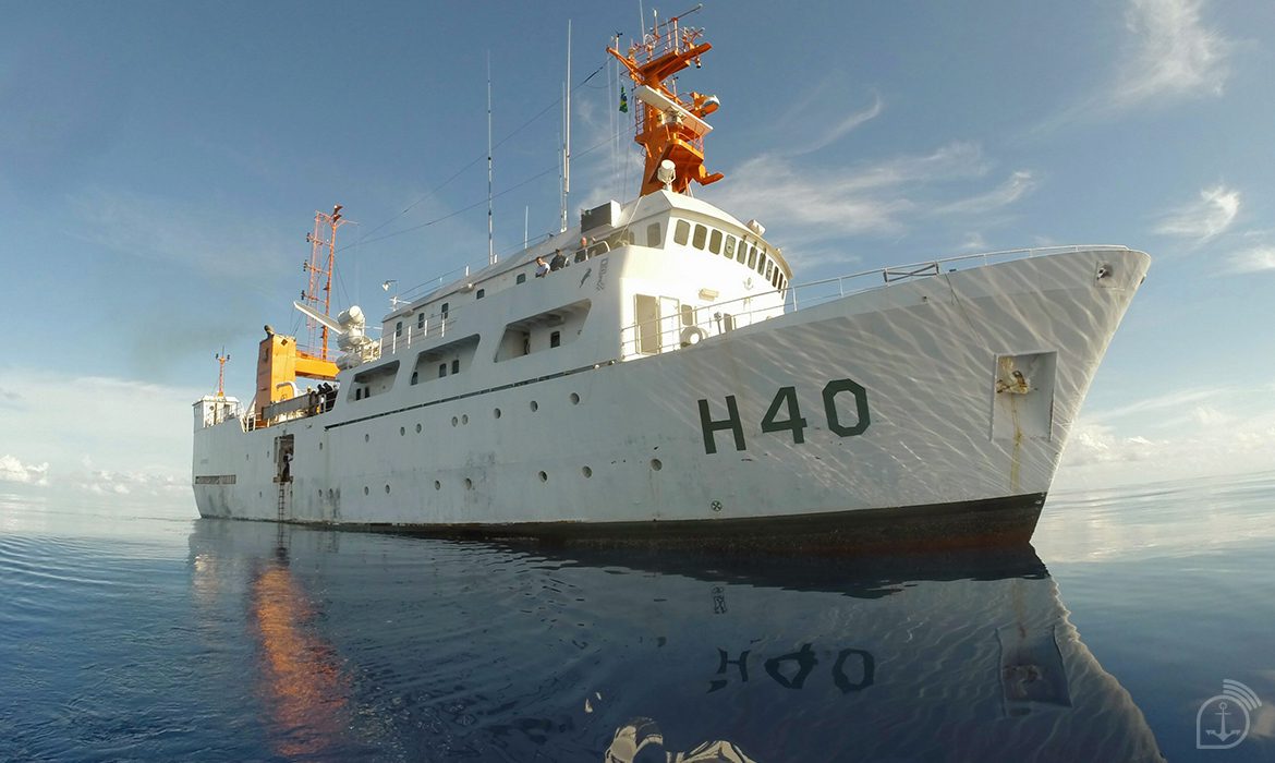
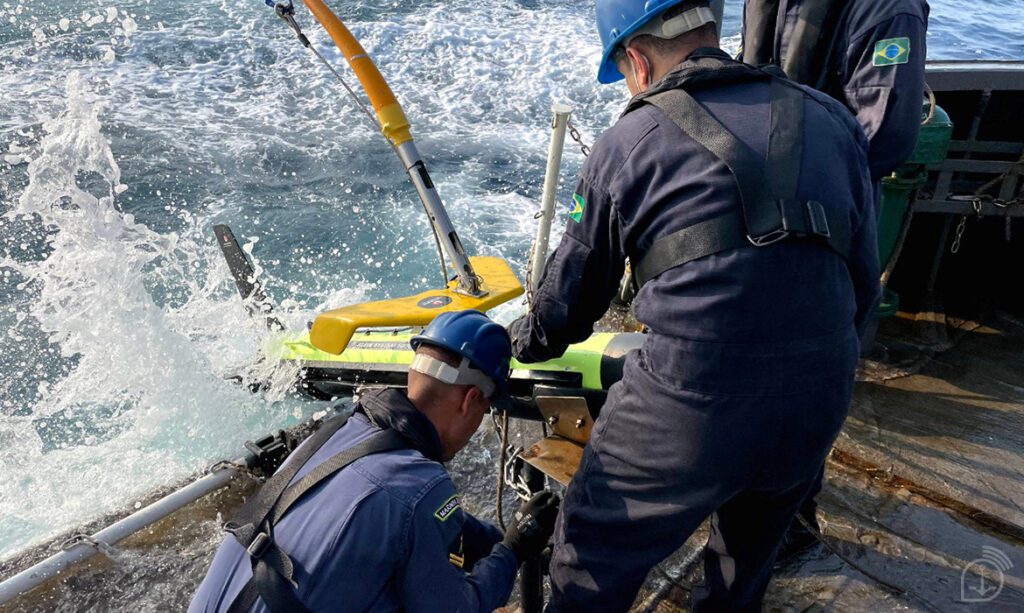
The work of these professionals, which is divided into “field activities” and “office activities”, is usually carried out by personnel serving on board hydrographic vessels. Because it is geospatial data collection, the place of execution depends on the type of information that is being sought. As an example, bathymetric, oceanographic, geological or marine meteorological data are mostly acquired at sea. On the other hand, topographic, coastal contour, tide gauge, and geodetic control data are obtained on land.
At the beginning of their career, this professional works more on collecting and analyzing environmental data, while on board. As the professional matures, he or she begins to work on land in analysis and quality control of environmental data or nautical signaling, occasionally embarking. Our commissions were once as long as a semester, but technological evolution, including differential GNSS positioning corrections and automatic recording equipment have brought speed, reducing hydrographic surveys to a scale of a set of weeks.
The great distinguishing feature of the profession is the interaction with the environment. To ensure the safety of navigation, the Hydrographer has an active participation in research related to the sea. He needs to understand and respect the sea, to understand the behavior of the waves, the direction of the wind, to observe the direction of the currents, to have a different look at places where the waves generate foam, to observe the unique characteristics of the place to be studied in order to configure his equipment correctly and obtain quality data. In short, it is up to him to unveil the secrets of the sea, to, at the end of his work, deliver a reliable product to society.
In terms of qualification, our Hydrographers, of yesterday, today and of always, need to be updated in relation to the new equipment and technologies that, more and more, allow the accomplishment of hydrographic surveys with more accuracy and speed. Therefore, the Directorate of Hydrography and Navigation (DHN) has constantly sought to improve the training of the members of the Brazilian Hydrographic Service, in the various areas of knowledge under its responsibility.
As part of the qualification of these professionals, during the training course for Hydrographic Officers and Commissioned Officers, on-board internships are conducted, as well as a complete hydrographic survey at the end of the course, guaranteeing that they achieve the integrated vision necessary for our activities, providing better conditions to follow the evolution of the sciences of interest, increasing the quality of the information and services rendered to navigators, and offering greater argumentation capacity to Hydrographers, in order to defend Brazilian interests in international forums and organizations.
The date that honors the profession portrayed in this interview is September 28 – Hydrographer’s Day, in deference to the birth anniversary of the Frigate Captain Manoel Antônio Vital de Oliveira, Patron of Brazilian Hydrography.
*** Translated by the DEFCONPress FYI Team ***