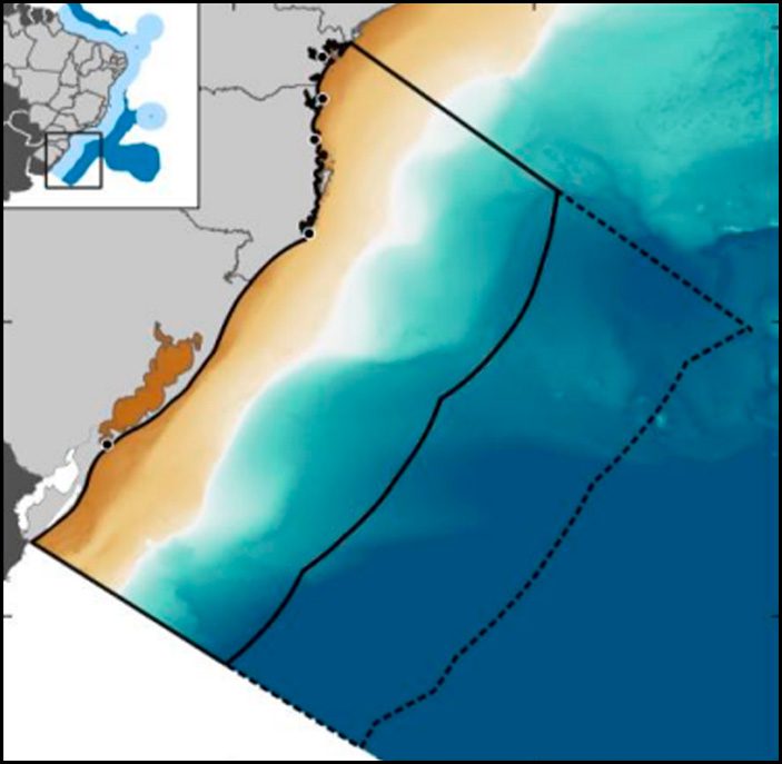
The first stage of Marine Spatial Planning will map the potential of Brazil’s southern maritime region.
By First Lieutenant (T) Paulo Yan Carlôto de Souza – Brasília, DF
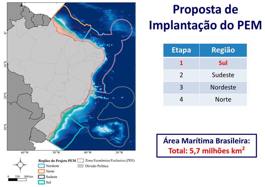
The maritime spaces that belong to Brazil are full of riches and potential. Known as the Blue Amazon, this area extends over 5.7 million km², which is equivalent to the size of the western portion of the European continent. In order to exploit these resources sustainably and efficiently, we need to know about them. Brazil is taking another important step in this direction by implementing the Marine Spatial Planning (PEM) pilot project in the south of the country – the first phase of this study that will guide the most efficient use of Brazil’s vast maritime area.
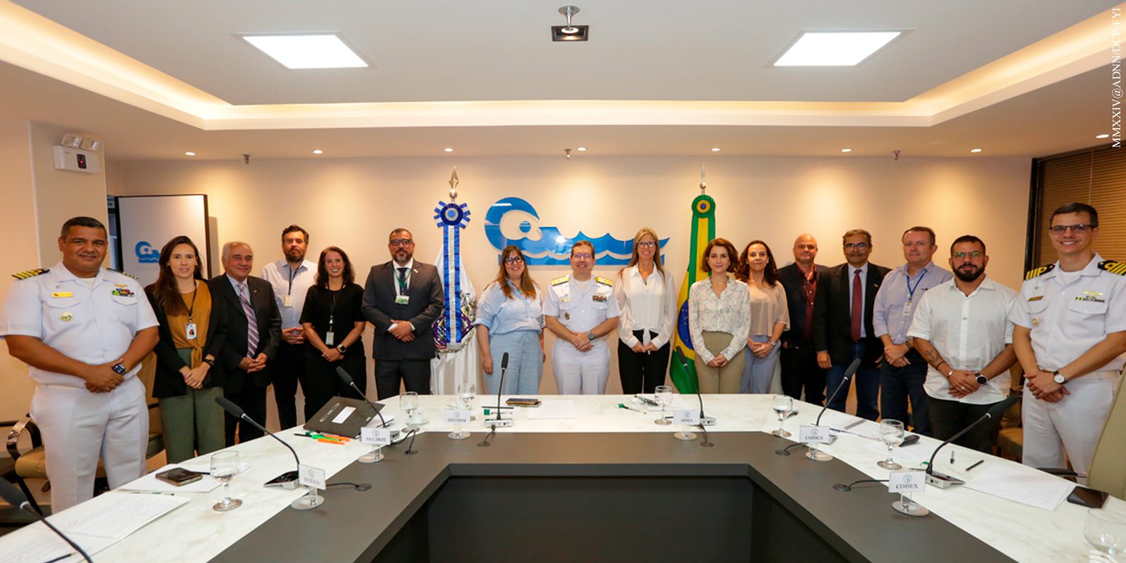
At an event held last Tuesday (27) at the Secretariat of the Interministerial Commission for Marine Resources (SECIRM) in Brasilia, Codex – the company contracted to carry out the study in the south of the country – presented its work plan. As this is a multi-sectoral project, which will guide various activities involving the use of the sea and the coast, the meeting was attended by ministries such as the Environment and Climate Change (MMA), Fisheries and Aquaculture, Mines and Energy, Tourism and Defense, as well as institutions such as the Federal Heritage Secretariat, the National Bank for Economic and Social Development (BNDES), the Brazilian Institute of Geography and Statistics (IBGE) and the Chico Mendes Institute for Biodiversity Conservation (ICMBio), highlighting the scope of this national project.
Codex, a company specializing in geomatics projects (acquisition, storage, analysis, dissemination and management of spatial data), has been contracted to lead a team that will include specialists from the Federal Universities of Rio Grande do Sul and Santa Catarina.
Pilot project in Brazil’s southern maritime region
During the UN Ocean Conference in 2017, Brazil made a commitment to implement the EMP by 2030. Planning is based on the process of organizing the use of the sea and should function as an instrument of territorial planning, taking into account ecological and socio-economic aspects.
Comprising the states of Paraná, Santa Catarina and Rio Grande do Sul, the southern maritime region was chosen to start the project due to the greater availability of data and the concentration of research institutions with a tradition in coastal and marine studies, as well as its representativeness in environmental, economic and spatial terms.
The Brazilian Navy is coordinating the PEM
For the Secretary of the Interministerial Commission for the Resources of the Sea, Rear Admiral Ricardo Jaques Ferreira, “the PEM is a study of the geographical and temporal allocation of the activities carried out in our Blue Amazon. This planning will guarantee greater order for all these activities and, as a final consequence, greater safety for waterway traffic in the Blue Amazon. In addition, we will have mapped all the activities that are carried out there, helping us to allocate all our resources to the defense of Brazilian interests in this area.”
The Admiral also added that, in accordance with the Sectoral Plan for the Resources of the Sea, the Brazilian Navy is coordinating the PEM together with the MMA. “The actions for Marine Spatial Planning had already been underway within SECIRM since 2013, but this year we managed, with financial support from the BNDES¹, to get the actions off the ground and gain more scope,” he said.
The event represented a continuation of the actions signed during the BNDES Blue launch ceremony, held last month on board the hydro-oceanographic research vessel “Vital de Oliveira”, when the PEM contract for the southern region was signed. There was also the launch of the PEM call for tenders for the Southeast region and the announcement of actions relating to infrastructure and the shipbuilding industry.
This first stage of the study will take around 36 months to complete. At the end, the project will provide data for a better understanding of the maritime area of the South region and will create the models that will serve as the basis for the study and mapping of the next stages: the Southeast, Northeast and North regions.
¹BNDES – Banco Nacional de Desenvolvimento Econômico e Social (BNDES) – The National Bank for Economic and Social Development (BNDES) is a federal public company based in Brasilia, whose main objective is long-term financing and investment in all segments of the Brazilian economy. The BNDES is an indirect public administration entity. The BNDES is an entity that makes up the indirect public administration and is linked to the Ministry of Economy, seeking to support entrepreneurs of all sizes, including individuals, in carrying out their plans for modernization, expansion and new business, in view of the potential for generating jobs, income and social inclusion in Brazil, with the aim of improving the competitiveness of the Brazilian economy and raising the quality of life of the population. It is one of the largest development banks in the world
*** Translated by DEFCONPress FYI Team ***