Projects from several universities embark in search of data at a depth of more than 4 thousand meters
By Lieutenant-Commander (RM2-T) Luciano Franklin de Carvalho – Brasília, DF
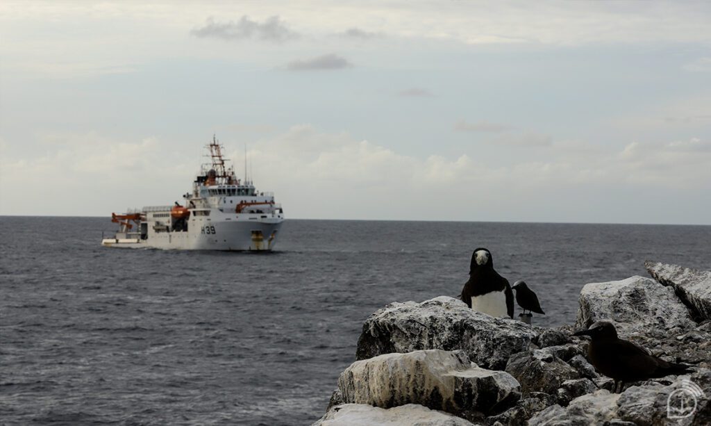
Despite not having large dimensions, the set of isolated rocky islands in the middle of the Atlantic Ocean, known as São Pedro e São Paulo, located about a thousand kilometers off the Brazilian coast, attracts more and more scientists in search of knowing its natural riches. And the interest is not new. The most famous visitor to the islands was Charles Darwin in 1832, during a trip around the world that culminated with the development of his famous theory of evolution.
The archipelago has a total emersed area of approximately 17,000 m², equivalent to about two soccer fields. Although small, the rocks have a rare formation and are surrounded by rich biodiversity, which provides unique conditions for research in various branches of science.
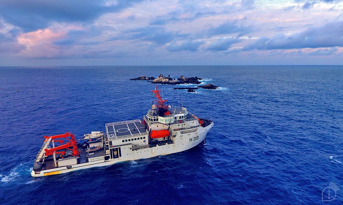
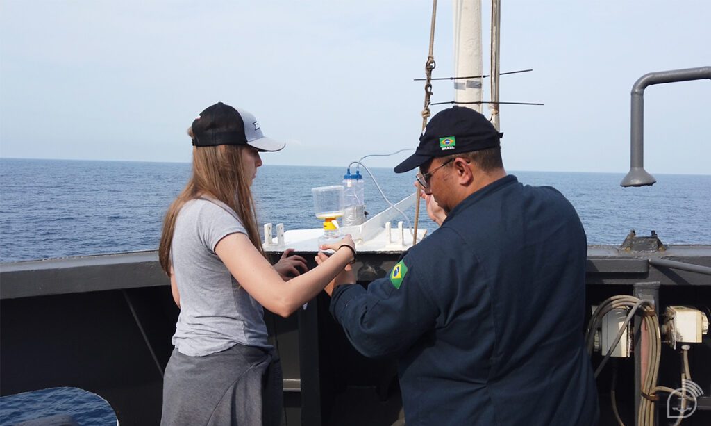
At the beginning of this month, the Brazilian Navy’s (MB) hydro-oceanographic research ship “Vital de Oliveira” took 23 researchers selected by the Ministry of Science, Technology and Innovations (MCTI) to collect data for scientific projects that seek to better understand what is happening around the islands.
For a period of 15 days, researchers from the Federal University of Rio Grande (FURG), the Federal Fluminense University (UFF), the Federal University of Rio Grande do Norte (UFRN), the Federal Rural University of Pernambuco (UFRPE), the Federal University of Santa Catarina (UFSC), the University of Vale do Rio dos Sinos (UNISINOS), and the University of São Paulo (USP) were aboard the Navy ship, focusing on this remote area of the Blue Amazon.
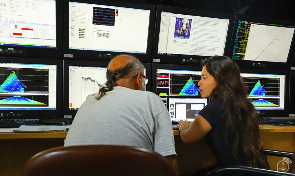
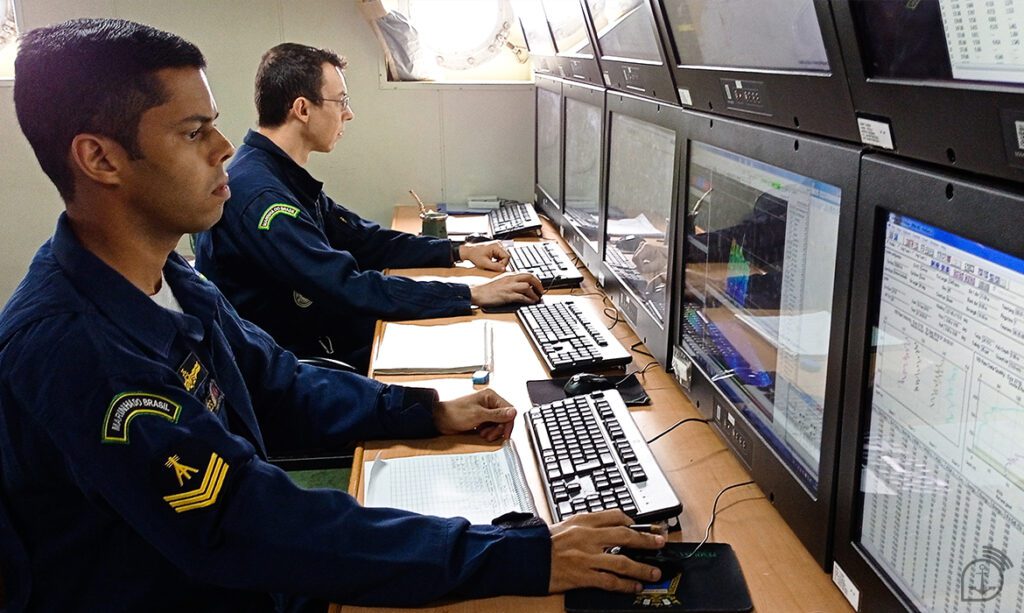
The diversity of institutions, from different regions of the country, proves the importance of and interest in this remote part of the national territory. Among the activities developed by the ship and by the researchers in this mission, the following stand out the study of persistent organic pollutants; the monitoring of seismic activity and bioacoustic emissions; the imaging of the ocean floor (a technique that generates images mapping the molecular composition of a given material); the characterization of fungi present in deep marine sediments of the Atlantic Ocean, with sample collection at more than 4 thousand meters depth; the evaluation of ecological factors and anthropic pressure acting on seabirds; the monitoring of marine biodiversity in Brazilian oceanic islands; and the monitoring of the distribution and abundance of cetaceans (whales and dolphins) between the coast of the Northeast of Brazil and the São Pedro e São Paulo Archipelago (ASPSP).
Project selection
The Technical Assistant of the General Coordination of Ocean, Antarctic and Geosciences (CGOA) of MCTI Iran Cardoso Júnior explains that, in the case of expeditions coordinated by the ministry, the agency consults researchers who have projects already approved by the National Council for Scientific and Technological Development (CNPq) or by the Coordination for the Improvement of Higher Education Personnel (CAPES), to enable the demand for embarked research. The process is done together with the Navy, which will analyze the logistical issue.
“We have begun to study with the personnel from the Hydro-Oceanographic Vessel Group the feasibility of the project, whether it is feasible in the intended areas, whether the ship has equipment capable of meeting certain demands,” highlights Cardoso.
In order to make the process more transparent, in August this year the MCTI launched a public consultation to identify the demands of the scientific community that wishes to use the research vessels. The interested parties have 30 days from the date of publication of the public notice to present projects that require the support of the ships.
For the Commander of the “Vital de Oliveira”, Frigate Captain Daniel Peixoto de Carvalho, “the operation of a military means with modern research equipment available to the scientific community produces a fundamental synergy for the exploration of natural wealth, being an excellent vector towards Brazilian prosperity and sovereignty”.
Professor Arthur Ayres is one of the researchers who was aboard the “Vital de Oliveira” ship bound for the archipelago. He conducts the research “Characterization and Biotechnology of fungi present in deep marine sediments in the Atlantic Ocean along the Brazilian coast,” coordinated by UFMG in partnership with UFF.
According to the specialist, research in this area helps to understand in advance what is happening with the ocean’s health and what is impacting the marine fauna and flora. He explains that, besides this, it is also possible to carry out studies that can contribute to the development of natural resource management, to biotechnological exploration (such as the production of pharmaceuticals), to geological and seismic studies (for the search of mineral resources), and to the preservation of species at risk of extinction.
According to the coordinator of the “Blue Amazon Sentinels” project, UFRN professor Renata de Sousa-Lima, who conducts bioacoustic research on cetaceans off the Brazilian coast, “the opportunities to conduct research in the region are scarce, because it is a difficult-to-access location and, therefore, with little known information. The fact that it is a little explored area makes the participation in the expedition even more special”. The project’s vice-coordinator, Manuela Bassoi, who studies the distribution of these animals between the coast of Rio Grande do Norte and the ASPSP, says that every opportunity to explore this region is unique. “The partnership with the Navy has helped us a lot in this regard,” she concludes.
The archipelago is in a critical point for navigation, because the islands are not easy to detect with the naked eye, especially in adverse light and weather conditions, which has already caused some shipwrecks throughout history. The origin of the name of the islands is precisely a reference to a rescue of sailors who had fallen off the Portuguese ship São Pedro and were rescued by the Lusitanian caravel São Paulo in 1511.
Strategic position
ASPSP is the closest point in Brazil to Africa, 1,820 kilometers from Guinea Bissau. The islands are also located in the northern hemisphere, near the Equator, a strategic geographic position between the northern and southern hemispheres and the African and South American continents. Their importance is also seen in terms of the economic aspect, as they belong to the route of migratory species of birds and of fish of high commercial value, such as tuna, for example.
Besides these aspects, the region is also relevant to Brazil in the geopolitical scenario, since, with the permanent occupation of the archipelago through the installation of a scientific research station, the country was able to add to its Exclusive Economic Zone (EEZ) an area of approximately 450 thousand km², equivalent to the size of the states of Paraná and São Paulo.
To learn more about the archipelago or the research carried out there, access the site of the Secretariat of the Interministerial Commission for the Resources of the Sea (SECIRM).
Hydro-Oceanographic Research Ship “Vital de Oliveira
The “Vital de Oliveira” began operating in 2015, the result of a Cooperation Agreement signed between the MB, the MCTI, PETROBRAS, the Geological Service of Brazil (SGB/CPRM) and VALE, to expand the infrastructure for marine scientific research.
The ship’s mission is to carry out hydro-oceanographic surveys, collect environmental data and support scientific research in maritime areas of interest, in addition to performing tasks related to navigation aids, in order to contribute to the fulfillment of activities related to the Directorate of Hydrography and Navigation.
The “Vital de Oliveira” is considered one of the most modern and complete research ships in the Southern Hemisphere. It has the capacity to act in several areas of hydrography (geophysics, oceanography, underwater acoustics, and meteorology) and also to support an enormous range of scientific projects from research institutions and universities that have interest in the living and non-living resources, water or seabed of the Blue Amazon.
Currently, one of the most prominent jobs of the ship is the imaging of the marine relief in the Rio Grande Rise, an area with an estimated extension of about 1 million square kilometers, which is being requested by the United Nations Commission on the Limits of the Continental Shelf.
For First-Sergeant (Hydrographer) Eric de Melo Silva, who has served on the ship for seven years, “it is a source of great pride to contribute to the protection of our Blue Amazon, because we actively participate in the development of scientific research that will help us preserve and sustainably use this enormous national heritage.
Source: Agência Marinha de Notícias *** Translated by the DEFCONPress FYI Team ***