
Even with high-precision systems, the Brazilian Navy still keeps astronomical navigation in its training schools
By Lieutenant-Captain (RM2-T) Camila Marques – Brasília, DF
Man’s fascination with the sky is so old that it can be verified in records made through paintings on rocks and caves in the Prehistoric period. The ancestors used the constellations, the moon, and the sun to find their bearings, understand cycles such as the seasons, and thus advance their understanding of agriculture, hunting, fishing, and navigation.
The Brazilian Navy still maintains the practice of traditional astronomical navigation as a means and method of vessel positioning. However, most of the time, the so-called “integrated gangway” is used, which is composed of advanced technologies such as Global Positioning System (GPS) and Automatic Identification System (AIS), radars that present high precision images, among other devices that provide safe navigation.
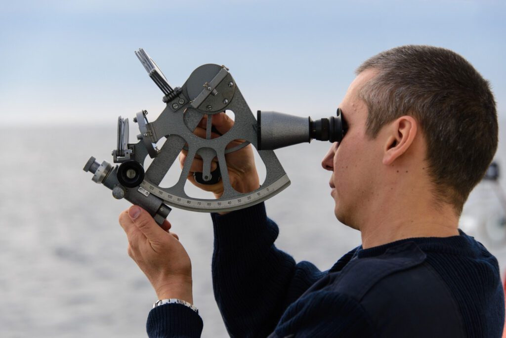
According to the teacher at the Centro de Instrução e Adestramento Almirante Radler de Aquino (CIAARA), Frigate Captain (Technical Staff) Ronald Domingues da Silva, although electronic navigation has come to replace astronomical navigation, training schools are still careful to keep astronomical navigation alive as a resource that does not depend on electricity and equipment. “With the use of a sextant, which serves to measure the angular distance vertically between a star and the horizon line, a calculator, and even with astronomical navigation tables, it is possible to determine the ship’s position. It is important that the navigator knows the principles of the movement of the stars and the ephemerides of the movement of the sun, moon, and celestial bodies”, he explained.
CIAARA professor, Corvette Captain Bruno Neves Baptista, related how the Navy uses orientation through astronomy. “One example is how the azimuth of the sun is taken, which is a measure of the angular aperture of the horizontal coordinate system, which aims to know the deviation of the magnetic needle, which are the compasses. The azimuth, first thing in the morning or at sunset, will give me the deviation of this magnetic needle. And this is important to know if the ship is going in the right direction.
To strengthen the knowledge of this way of navigating, the Navy often promotes astronomical navigation exercises on board its ships.
The Sextant
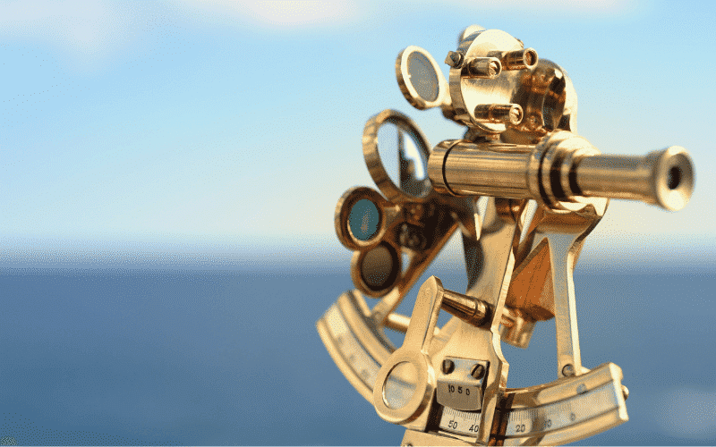
The sextant is an instrument designed to measure the vertical angular distance between a star and the horizon line, thus calculating the position and correcting any errors in an estimated navigation. It is an instrument essentially designed for the observation of the height of the stars, sun, moon, planets and stars, but nothing prevents it from being used to calculate distances by measuring vertical angles from the point of observation to a given object, for example a lighthouse.
Frigate Captain Ronald explains that, since the early days of astronomical navigation, quadrants and the astrolabe have been used, but they were not for great navigations. “At the time of the discoveries, at the end of the 15th century, other equipment began to be developed, such as the sextant, which is still used today on ships to know the height of the star. A real example I can give you is what happened to me in the 90s, when I made a trip from Brazil to Japan. Before I acquired the expertise it took me 25 minutes to deliver a final calculation. As a comparison, I can say that the old-timers took up to an hour to get a return. With the new technologies, in five minutes of observation and calculation we already have the return of the ship’s positioning,” he concluded.
Source: Agência Marinha de Notícias